


June 5 is the anniversary of the Six Day War. After the war, Israel occupied the West Bank, East Jerusalem, Golan Heights, Sinai Peninsula, and Gaza. Israel soon began to create settlements, Israeli communities built in the occupied territories. Today, settlements remain in place in the West Bank, East Jerusalem, and Golan Heights.
The creation and maintenance of the settlements are a key issue in the peace process. In 1979, Israel removed its settlements from the Sinai Peninsula as part of the Camp David Accord. In 2005, settlements were removed from Gaza. Settlements were some of the most important issues in the Oslo Accords (1993) and the Roadmap for Peace (2003).
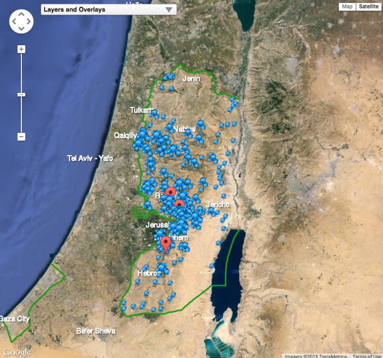
Where are the settlements? Americans for Peace Now (APN) maps each settlement along with data on its creation and population. The map also includes
- Each settlement or outpost
- Palestinian residential area
- Green Line (1949 Armistice Line, the demarcation line between Israel and neighbors after 1948 war)
- The West Bank Barrier (430 mile barrier being built by Israel along parts of Green Line or in the West Bank)
- Israeli Municipal Jurisdiction (land set aside for possible settlements)
The map should be of interest to anyone concerned about Israel and region. That said, APN is not impartial on the issue of settlements. APN is the American affiliate of Shalom Achshav, a peace movement in Israel. APN states that it is “deeply opposed to Israeli settlement creation and expansion in the West Bank and East Jerusalem.”
Don’t miss any more posts from the Corner of Church & State. Click the red subscribe button in the right hand column. Follow @TobinGrant on Twitter and on the Corner of Church & State Facebook page.